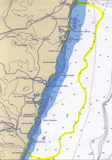
Pernambuco South Coast, from the Jaboatao river until the Persinunga river in Sao Jose da Coroa Grande-PE :
Mar/2010 – The achievement of this harmonization was possible mainly due to the interest and support of Dr. Fernanda Duarte Amaral – UFRPE and her group of advisees students who accompanied us throughout the recognition process and were willing to keep track of marine biodiversity evolution.We also thank for the collaboration of Dr. Beatrice Padovani Ferreira from UFPE and general coordinator of the Reef Check Brazil, who gave us the means for recognizing in Tamandaré (PE).The recognition of the South Coast was done by steps with dives in the following points:
1. Porto de Galinhas – PE, natural pools in position: latitude S 8° 30.685 ” and longitude
W 34° 59.902″
Biotic level recorded: zero to +15
2. Tamandare – PE, Trilha do Entorno near of protected area in the position:
latitude S 8° 45.832″ and longitude W 35° 05 320″
Biotic level recorded: zero to +35
3. Tamandare – PE, Pirambu – North Side in the position: latitude S 8° 45.434″ and longitude W 35°05.141″
Biotic level recorded: zero to +35
4. Sao Jose da Coroa Grande – PE, due to the lack of dive operators for on-site evaluation, we chose an evaluation at a distance.
Biotic level recorded: zero <zero>zero
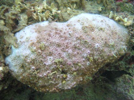
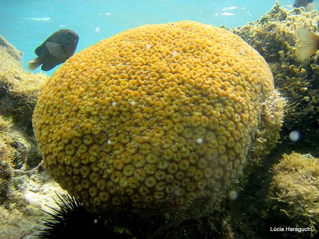
Although Pernambuco coast has not undergone any massive bleaching process already has been observed the bleaching occurrence motivated mainly by sedimentations, climate change effects, diseases and other harmful actions.
Among the hard coral that has been hardest hit there are: Mussismilia Braziliensis, Mussismilia Hispida, Mussismilia Hartii and Siderastrea Stellata.The protect marine region of Tamandare – PE that is integrated in the APA Coral Coast has a privileged situation to corals’ conservation and its evolution.
The protect marine region of Tamandare – PE that is integrated in the APA Coral Coast has a privileged situation to corals’ conservation and its evolution.
Some recorded photos of the corals status on the occasion of our recognition in March/2010 are available at:
https://drive.google.com/drive/folders/14zHpHwnI0HBx65WrwbTxYh24To-SyDts
The yellow line on the map below demarcates the limits of the region which has been harmonized, covering APA Coral Coast in Pernambuco state and reaching all continental platform until 30 meters depth: